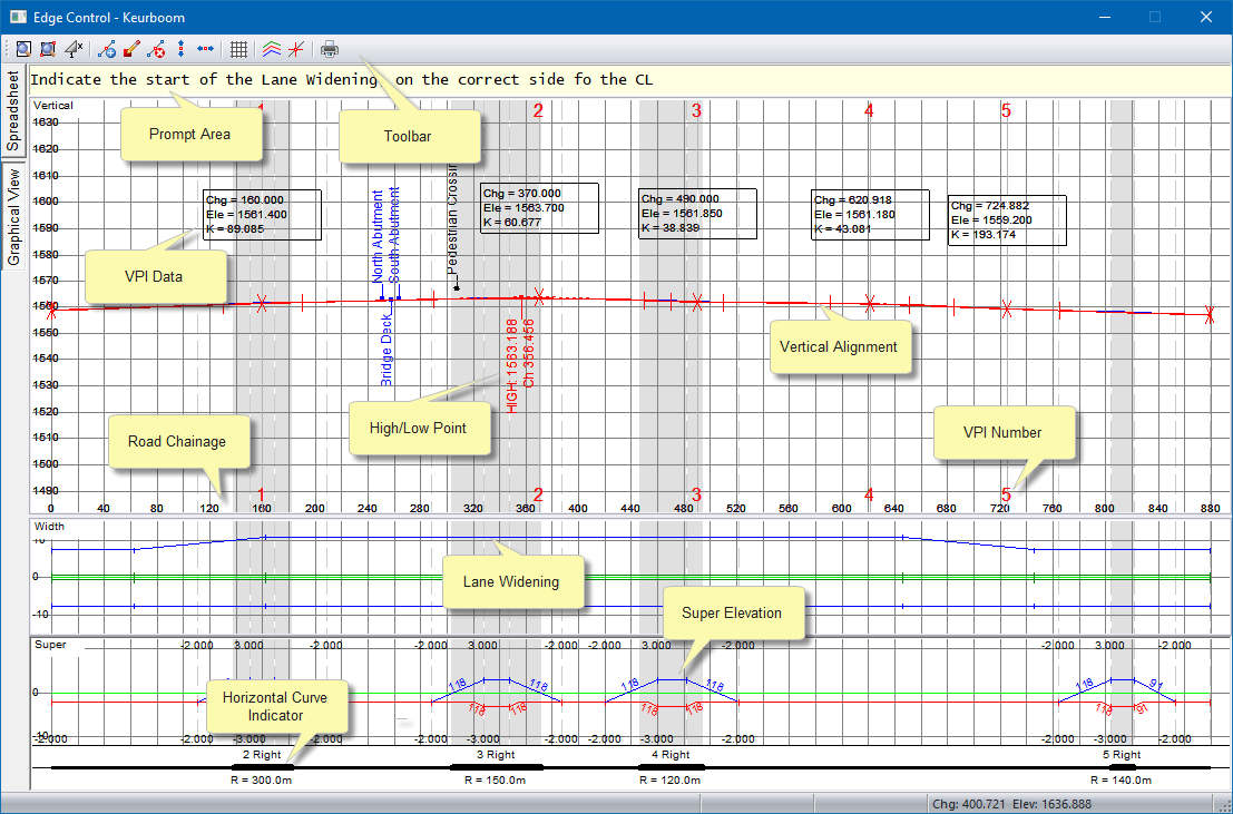
Three graphs are displayed.
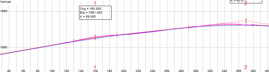
The top graph displays the vertical alignment plus selected ground lines and annotations.
The middle graph represents the road widths.
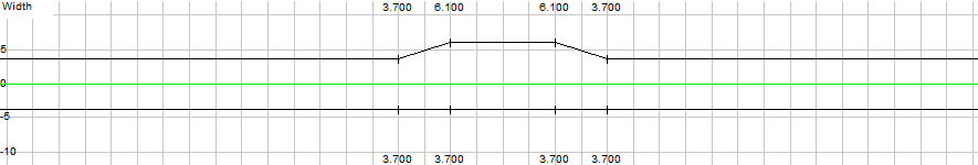
It's X-axis represents chainage values in metres, while it's Y-axis represents widths in metres. Apart from the graphical editing functions documented below, there are also a number of shortcut keys that can be used to manipulate the view or to edit the alignment.
The lowest graph represents the superelevation data.
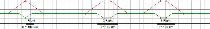
It's X-axis represents chainage values in meters while it's Y-axis represents superelevation rates in percentage. The horizontal alignment will be indicated by a line at Zero superelevation. Horizontal curves will be indicated by thick lines, while transition curves will be indicated as gaps in the line.
A popup menu can be displayed by right-clicking:
The following options are available from the toolbar or the right-click popup menu.
|
Option
|
Description |
|
Insert Point |
Insert a Super/Width break point. |
|
Edit Point |
Edit a Super/Width break point. |
|
Slave Edit |
Display the Slave Super settings for the selected horizontal curve. |
|
Delete point |
Delete a superelevation/road width change point. |
|
Move Point |
Move a Super/Width break point. |
|
Lane widening |
Graphically widen a lane. |
|
Settings |
Display the Edge Level Lines settings. |
|
Review Alignment |
Review the Edge Levels. |
|
Generate Edge Levels |
Generate Edge Levels. |

The toolbar at the top of the graphical view allows access to a number of setup and editing functions.
|
Icon
|
Description
|
|
Redraw. |
|
|
|
Zoom Window. |
|
|
Change vertical exaggeration. |
|
Insert a change point in the road width (top pane) or the superelevation (lower pane). |
|
|
|
Edit an existing change point in either the road width or the superelevation. |
|
Delete an existing change point in either the road width or the superelevation. |
|
|
|
Move an existing change point vertically in either the road width or the superelevation. |
|
|
Move an existing change point horizontally in either the road width or the superelevation. |
|
|
Grid display settings. |
|
|
Edge level line display settings. |
|
|
Track the cursor position on the horizontal alignment. |
|
|
Print. |