Home > Roads Mode > Alignment > Edge Levels > Edit Super
Edit edge control data.
|
Icon |
Command |
Shortcut Key |
Toolbar |
|
|
RD_SUPEREDIT |
|
|
The edge level control data is stored in ASCII format in the design file of the active road. Entry is done via a Spreadsheet. You can also display the superelevation and lane widths graphically in the Graphical View.
Procedure
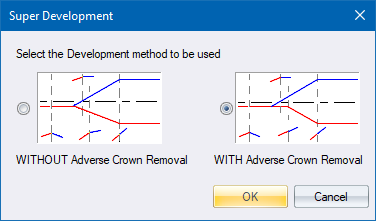
When selecting this option for the first time, the Super Development options display.
You must select the super elevation development method you want to use. The method you select reflects in the Graphical View of the superelevation, and when generating edge levels.
The Edge Control window displays. There are two view tabs on the left of the window:
Spreadsheet View
Graphical View
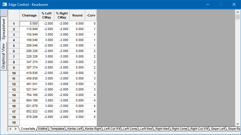
The data in the spreadsheet controls the:
Crossfalls
Left and right widths of the road
Templates to be used
Kerbs to be used on the left and right edges of the road
Components that have been added to the cross-section left and right
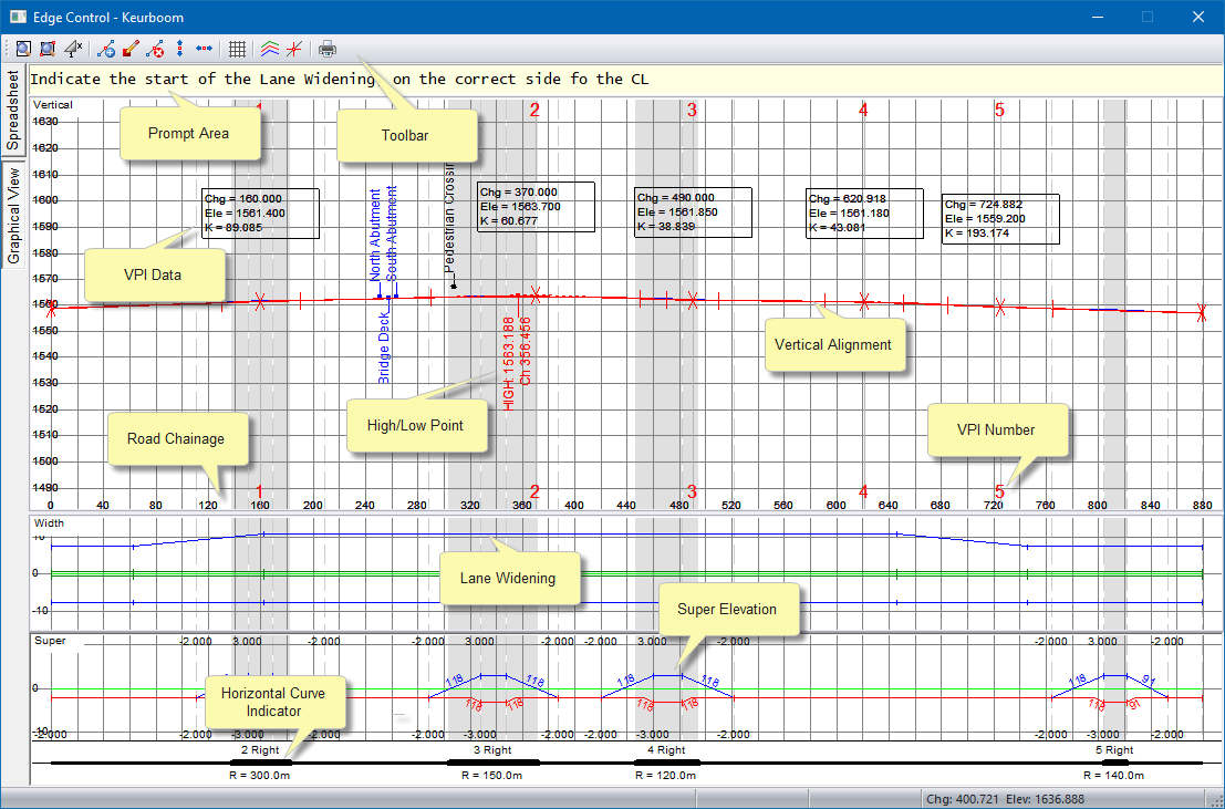
The Graphical View displays the edge level data in the form of three graphs - vertical alignment, road width and super-elevation from top to bottom, respectively.