Home > Survey Mode > Reductions > Levelling > Reduce Field Book
Process Levelling data from the spreadsheet.
|
Icon |
Command |
Shortcut Key |
Toolbar |
|
|
SurveyLevelReduce |
|
|
This function allows you to reduce and adjust spirit levels by the rise-and-fall method.
Two basic types of fieldbooks are catered for:
The first is for the reduction of a normal level traverse.
See the New Field Book section for details.
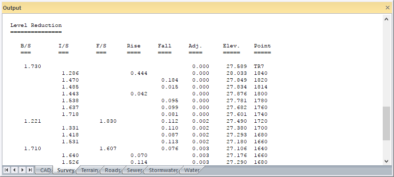
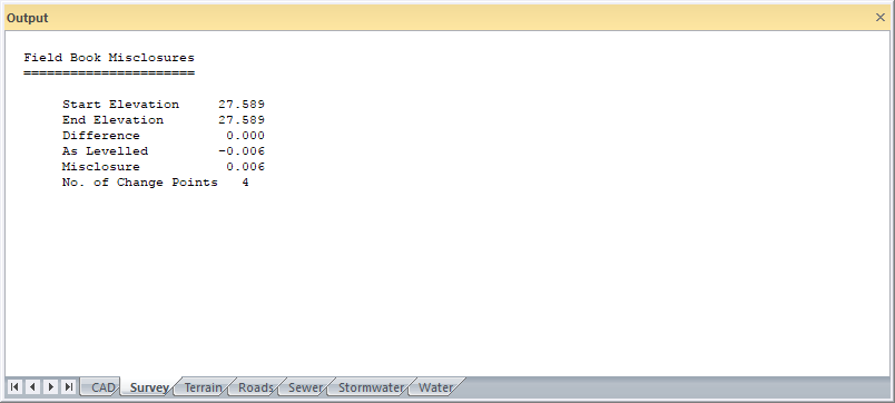
Before running a reduction make sure that the Output window is visible.
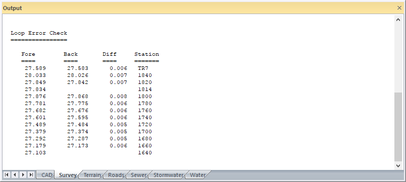
The field book data are reduced and the mis-closure is calculated and displayed in the Output window for adoption. If the mis-closure is accepted, the adjusted elevations are calculated and printed.
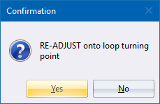
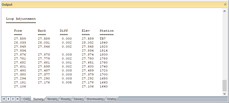
In the case of a loop (traverse starts and ends on the same point), there is the option to also adjust the traverse onto the elevation of a known turning point. Any common points (points with the same name) will have their elevations meaned. If there is no particular turning point, or there is a turning point but its elevation is unknown, the default turning point elevation should be accepted. In this case there is no re-adjustment of the traverse but the common points are still meaned.
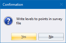
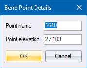
An option exists to write the elevations as the z ordinates of the points bearing same name in the database.
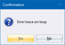
If the mis-closure is unsatisfactory and the level traverse is either a straight run or a loop without common points, there is very little that can be done except to inspect your field book entries very carefully. However, if there is a loop that contains common points in the forward and back runs, any mistake can be rapidly isolated by running the full reduction and looking for anomalies in the final means.
If the Level Traverse is of a road, it is advisable to create the chainages in Horizontal Alignment in the Road Menu and store them before reducing the field book so that the final elevations can be automatically added to the road chainage coordinates on file.
In the case of levelled sections, the option is provided to store the cross-sections in Civil Designer ASCII format so that they may be imported into a road database at a later stage.
Procedure
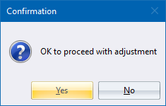
Click Yes to proceed with the adjustment; or No to cancel the adjustment.
If you click No:
If you click Yes: