Update node cover levels.
|
Icon |
Command |
Shortcut Key |
Toolbar |
|
|
SEWERGRAPHICALNODECOVERLEVELS |
|
|
This function allows you to extract levels from the digital terrain model, and update the node cover levels of all the selected nodes.
Procedure

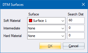
Specify the surface to be used to interpolate the cover level, and then click OK.
The program scans the database and extracts a cover level for each selected node. If no nodes have been selected, the following message displays:
No nodes selected
Use the Graphical ► Mark functions to select nodes.