To use the routine, it is essential that the long section is collected from named bend points using Terrain ► Long Section ► Extract.
Auto-generate a pipe alignment using manholes.
|
Icon |
Command |
Shortcut Key |
Toolbar |
|
|
RD_PIPEAUTOMANHOLES |
|
|
This function allows for the rapid insertion, and visible display, of manhole and pipe details.
To use the routine, it is essential that the long section is collected from named bend points using Terrain ► Long Section ► Extract.
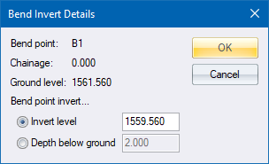
When the routine is selected, you are prompted to enter the layer to be used for the ground layer. For every manhole on the pipeline, you are prompted for an invert level or the depth below the ground level.
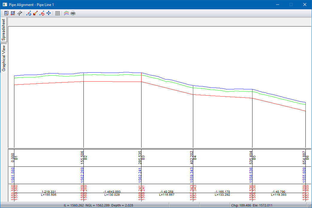
To view the line, click Redraw in the Roads window. The pipeline you've created is now displayed on the screen. Note that a secondary line, the minimum cover depth below the ground, appears as an aid to further editing.
The long section can now be edited using the graphical functions, or by editing the data in the spreadsheet.
Select Review Alignment to list alignment details.
Procedure
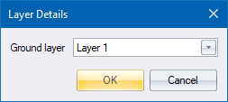
Select the road layer the ground long section is stored in, and then click OK.
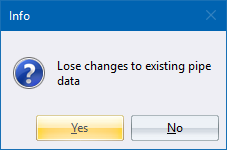
Click Yes to overwrite the existing alignment with the new alignment; or No to cancel the function.
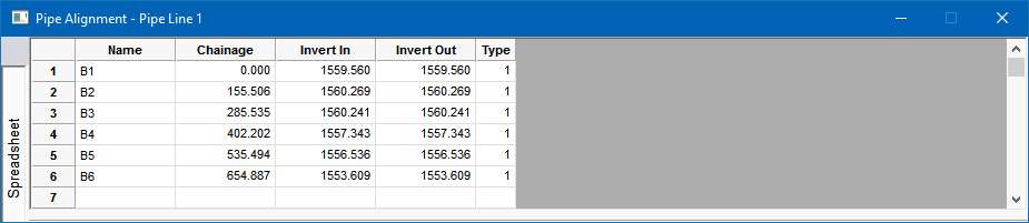
The long section looks as follows.