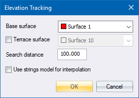
Dynamically track elevations on one or two terrain surfaces.
|
Icon |
Command |
Shortcut Key |
Toolbar |
|
|
TERRAINELEVATIONTRACK |
|
|
This function allows you to dynamically track the elevations on one or two surfaces, as the mouse is moved over the project. When tracking elevations on two surfaces, the height difference between the tracked elevations is displayed in addition to the elevations themselves.
Procedure
Select the base surface and optional second surface, and then click OK. As the cursor is moved over the terrain, elevations are interpolated from the selected surfaces and displayed in the window.
Surface 1 height = 1561.000
When tracking two surfaces, the following information displays:
Surface 1 height = 1560.907 : Surface 2 height = 1562.000 : Diff. = 1.093
Click to insert a new DTM point, or press [Esc] to exit the function.
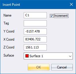
Fill in the relevant details and click OK.