Auto-generate a pipe long section parallel to the ground line.
|
Icon |
Command |
Shortcut Key |
Toolbar |
|
|
RD_PIPEPARALLELPIPES |
|
|
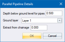
This function creates a pipeline at a set depth below the ground. The line "hugs" the ground, and is therefore suitable for pressure mains, irrigation lines, etc. A multitude of pipe lengths is created and it is normal to graphically delete many of them immediately after creation.
You need to enter the minimum depth below the ground line, the layer to be used for the ground layer, and the chainage to start from. The function then generates invert levels and grades that follow the natural ground line of the section.
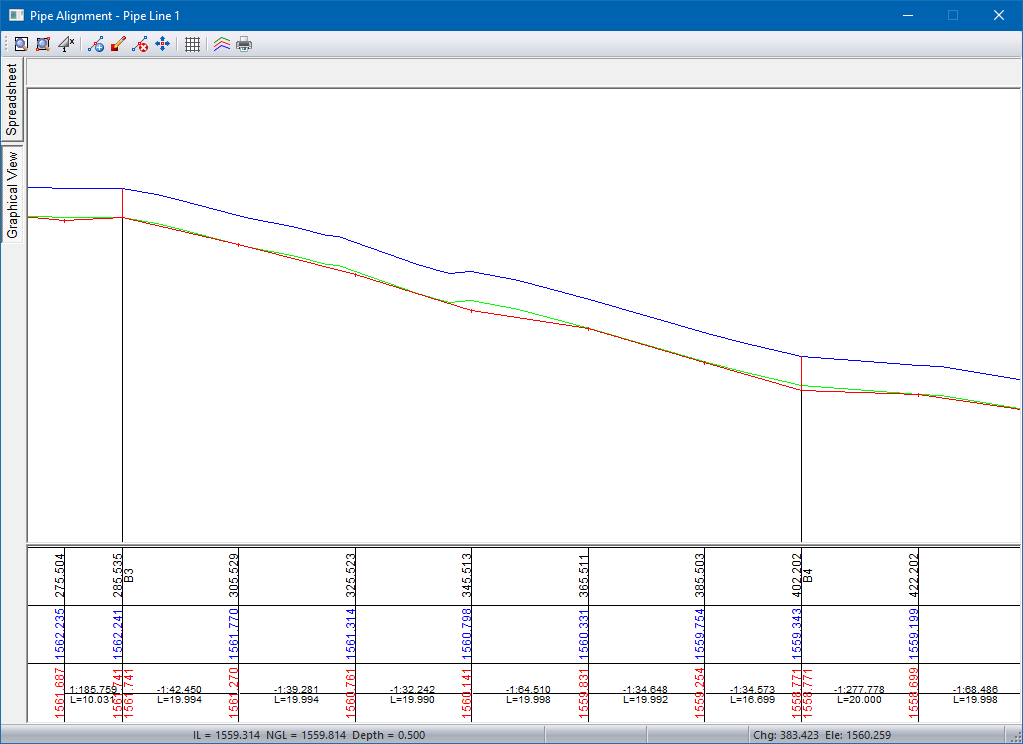
To view the pipeline, click Redraw in the Roads window. The pipeline generated is then be displayed on the screen. Note that a secondary line, the minimum cover depth below the ground, appears as an aid to further editing.
The long section can now be edited using the graphical functions, or by editing the data in the spreadsheet.
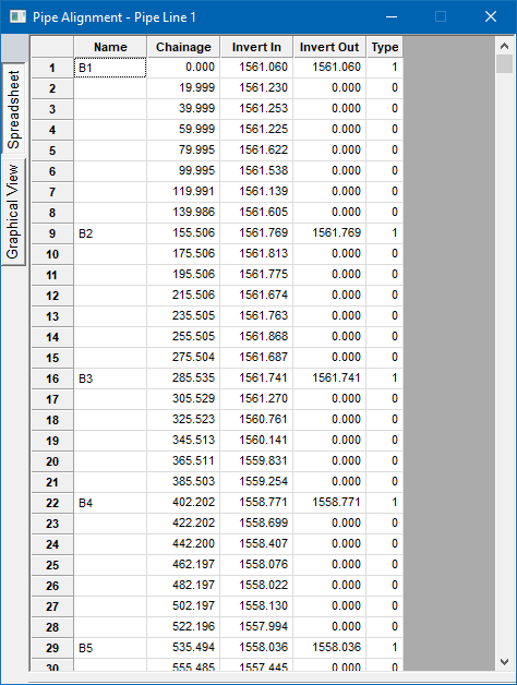
Select Review Alignment to list alignment details.
Procedure
Fill in the relevant data and click OK.
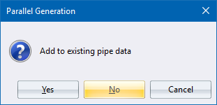
Click Yes to add to the existing pipe data; click No to overwrite the existing alignment; or click Cancel to cancel the function.
The pipe long section is generated with a bend at every bend in the ground line.