Home > Plan Road Junction List
This section controls the drawing of the road intersection coordinate list on the plan.
Option
|
Description |
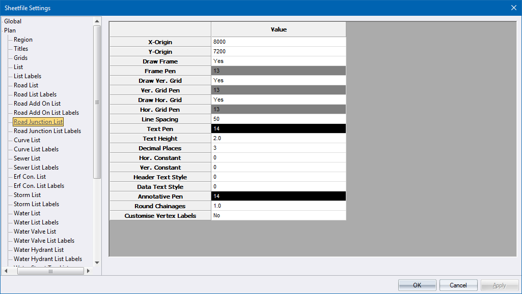
X-Origin and Y-Origin |
Specify the position of the top-left corner of the list. |
Draw Frame |
Select whether the list should be framed. |
Frame Pen |
Select the pen in which to draw the list frame. Right-click the cell to display the pen selection. |
Draw Vert. Grid |
Select whether vertical lines should be drawn for each column. |
Vert Grid Pen |
Select the pen in which to draw the vertical lines. Right-click the cell to display the pen selection. |
Draw Hor. Grid |
Select whether horizontal lines should be drawn for each row |
Hor Grid Pen |
Select the pen in which to draw the horizontal lines. Right-click the cell to display the pen selection. |
Line Spacing |
Enter the vertical spacing between successive rows in the list. |
Text Pen |
Select the pen in which to draw the list text. Right-click the cell to display the pen selection. |
Text Height |
Enter the text height in mm. |
Decimal Places |
Enter the number of decimal places to be displayed. |
Hor. Constant and Ver. Constant |
Enter the constants (in metres) to be subtracted from coordinate values before the text is drawn. |
Header Text Style |
Select the text style in which the header text should be drawn. |
Data Text Style |
Select the text style in which the data text should be drawn. |
Annotative Pen |
Select the pen in which to draw the annotations. Right-click the cell to display the pen selection. |
Round Chainages |
Enter a value to filter the listed chainages. e.g. a value of 100 lists chainages at 100m intervals. |
Customise Vertex Labels |
Set to Yes if you want to customise the vertex labels on the Plan view of the intersection. The plotted layout will insert the customised labels. The angle at which the labels get plotted is perpendicular to the curve of the intersecting road. If set to Yes, the Vertex Label Text Setup window displays. |