Identify the probable extent of a terrace.
|
Icon |
Command |
Shortcut Key |
Toolbar |
|
|
TERRAINTERRACETOP |
|
|
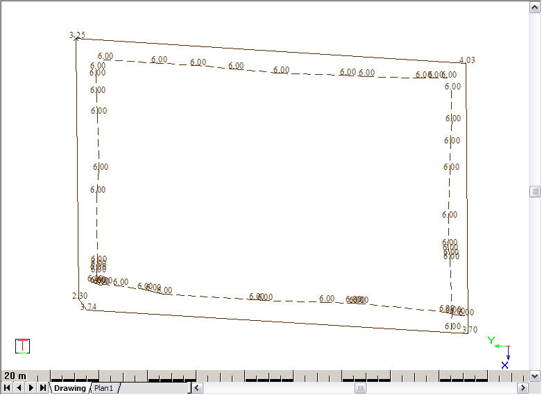
This function allows you toidentify the probable extent of a terrace if the perimeter of the outsides of the banks is known. It is typically used to maximise a platform within a property boundary.
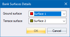
The surfaces of the terrace and the base, a reference point on the outside perimeter for the banks, the platform level, and the cut-and-fill slopes are entered.
The routine interpolates points inwards from the perimeter, to indicate the limits of a theoretical platform. It is normal to use these displayed data points to visually insert final terrace corner points, at locations that make optimum use of the space available but still provide a pleasing aesthetic appearance.
Procedure
Fill in the relevant data and click OK.
Snap on terrace point
Click on one of the terrace points.
Once the terrace has been located, the Terrace Base Details display.
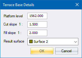
Fill in the relevant data and click OK.
Additional points are inserted into the DTM defining the top of the terrace.