Graphically identify all the details known about a point.
|
Icon |
Command |
Shortcut Key |
Toolbar |
|
|
TERRAINIDPOINT |
|
|
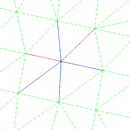
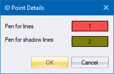
This function allows you to display lines, which are connection from this point to surrounding points; and shadow lines, which are connections to this point from other points. The lines and shadow lines are displayed in user-selected pens.
This function is useful when trying to identify errors in the bounding polygon of a site. It sometimes happens that what appears to be a clean edge is actually broken, as there are duplicate points with different line connections. Using this function, you can identify the points and lines that actually make up the boundary and thereby identify the error.
Procedure
Fill in the relevant data and click OK to continue.
Snap on point to ID