Road Footprint Area

Calculate road footprint areas.

Icon

Command

Shortcut Key

Toolbar


RD_AREAVOLFOOTPRINT


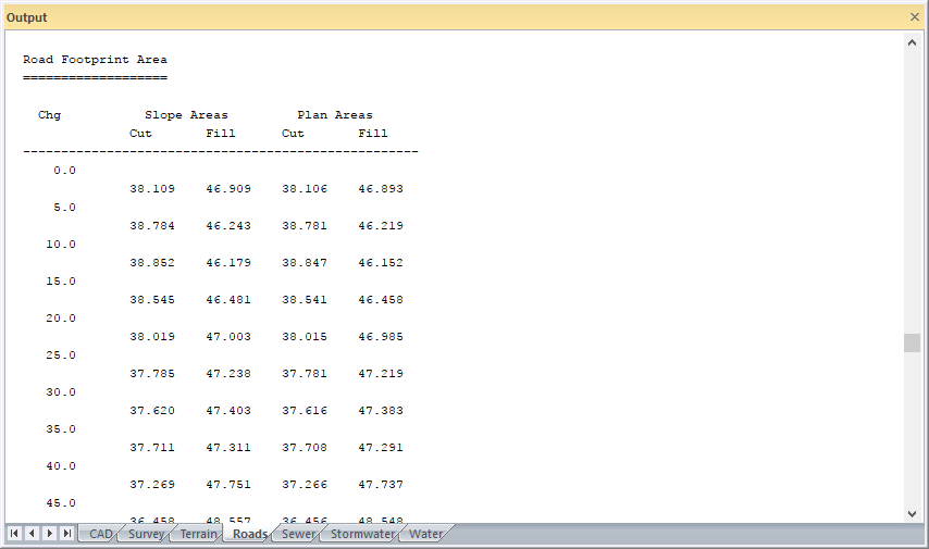
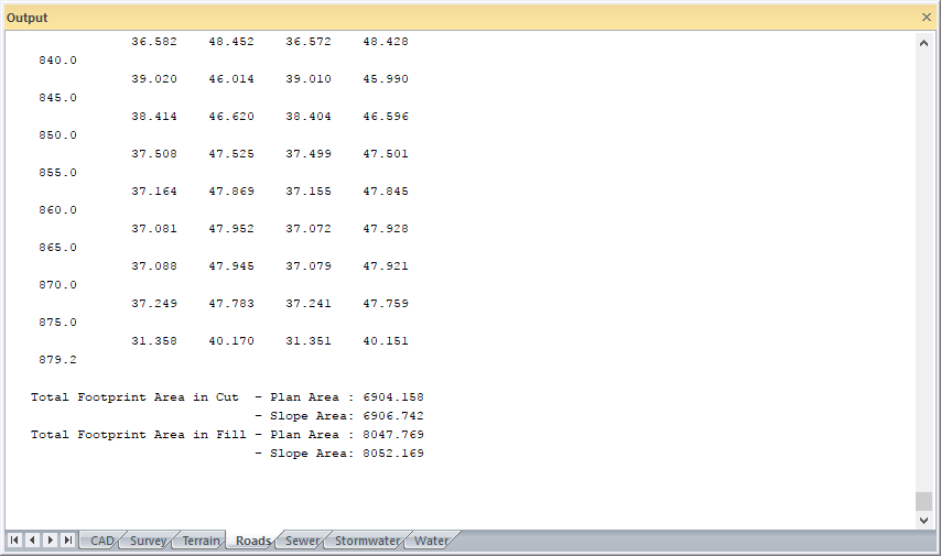
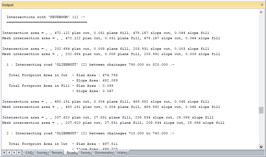
This function allows you to calculate the plan and sloped areas in cut and fill, for the road footprint.
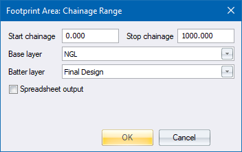
Procedure

  1. The Chainage range displays.

  1. Click OK to calculate the road footprint area in cut and fill.

  2. The plan and slope areas for cut and fill are printed per chainage interval.

  1. The total plan and slope areas for cut and fill for the road, excluding intersections, are printed next.

  1. Lastly, the footprint areas of each intersection are outputted.