Home > Roads Mode > Alignment > Vertical > Generate Levels
Generate Levels
Generate centreline levels.
|
Icon
|
Command
|
Shortcut Key
|
Toolbar
|
|
|
RD_VERGENERATE
|
|
|
This function allows you to generate elevations along the alignment for the chainages in the road file. A start chainage and stop chainage must be supplied. These chainages should fall within the available range of the alignment.
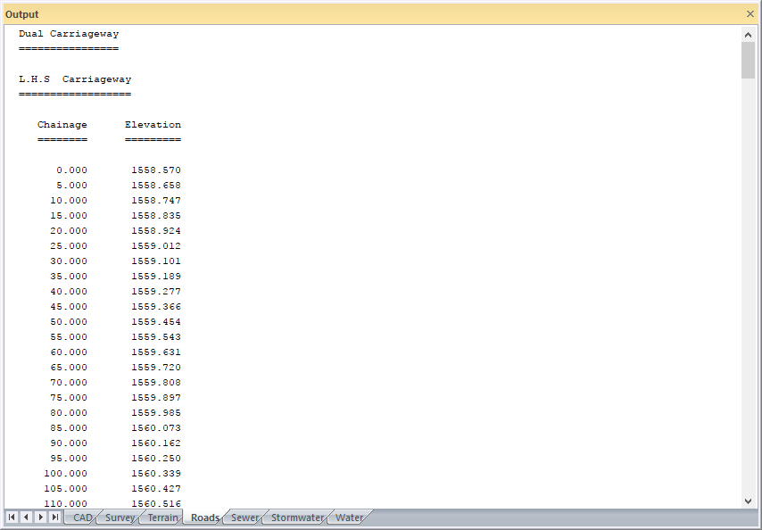
The generated levels are stored in Layer 128 of the active roads database. In the case of Single Carriageway roads, they are stored on the centerline and, for Dual Carriageway roads, 0.5m left and right of the centreline. Layer 128 can be manipulated as a normal cross-section for plotting purposes, and is always assumed to hold the current elevations for the designed chainage values.
 Layer 128 can also be edited and used for data entry. This means that designs can be produced that follow no alignment whatsoever. This is useful in circumstances such as re-skinning or wearing layer modifications, as well as shoulder widening. This is because survey data can be inserted into Layer 128 automatically and this becomes an "alignment", but no vertical adjustment to the existing layer takes place.
Procedure
- The Chainage Range Details display.
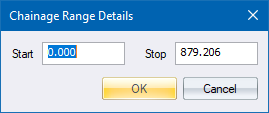
- Fill in the relevant data and click OK to continue. The levels are generated.